June 13, 2021
Research on Digital Earth

Our situation awareness has expanded exponentially as satellite sensors swarm the Earth and ground-based systems measure and communicate trillions and trillions of observations each day. Consider the information collected by your smart phone alone. Maps of our personal surroundings are a click away and free if we choose to share our location, triangulated to sub meter accuracy from space. Every sector of our economy is touched by this location revolution. Infrared imagery expose vegetative stress from autonomous crop spraying drones. LiDAR surveys become a bare earth surface model for a mountainous forestry road design. Cargo is shipped and tracked, floods are predicted, lives even saved. This prolific output from geomatics engineering has changed the world.
It might seem that all the pressing challenges in location-based technology have been solved. One doctoral student in the Geomatics Engineering Department at Schulich School of Engineering would disagree.

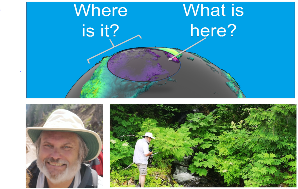
Perry Peterson has just been awarded the Natural Sciences and Engineering Research Council of Canada prestigious Alexander Graham Bell Scholarship for his research aimed at building a better map, what he calls Digital Earth. “I love exploring new places. My brain is so excited to discover the things that fill up unknown space. This past weekend my wife and I explored around the Mount Arrowsmith biosphere near our home on Vancouver Island. We walked trails along the Englishman and Qualicum Rivers. The fresh smell of a healthy rainforest is unforgettable. We watched peaceful streams drop into powerful deafening torrents. We noticed the water had exposed conglomerates of metamorphic stone above limestone layers and even older rock many millions of years old. We talked about the salmon that had evolved to find their way to the pool beneath the falls far before the first people had arrived and the towering Douglas-firs that demonstrated that a single life can span the millennium. We became mesmerized by the behavior of a belted kingfisher’s swift pursuit of salmon fingerlings in the stream. In those moments, I connected. It interests me that I might now fight to my death to protect this place which was an unknown space a few days ago. I wish everyone could connect to the entire planet in this way.”
It is Peterson’s belief that we remain far too disconnected from the remote settings we are damaging. “Development of positive human empathy requires connection. Our brains have not evolved to care about a forest 6000 kms from here or 100 years from now. While maps are one of humanities greatest innovations, connections do not happen on a map. We need something more to evoke our empathy.”
Digital Earth is a novel spatial analysis system that was first discussed by Al Gore in his book Earth in the Balance (1992) and in a speech written for him called The Digital Earth (1998). Gore speech describes a magic carpet ride where all the world’s geographic information can coalesce on-demand while a curious young child navigates over a globe. University of Calgary has been a hot bed of Digital Earth application research under Professor Faramarz Samavati of the Computer Sciences Department and Professor Emmanuel Stefanakis in Geomatics Engineering. With the support of NSERC’s Alexander Graham Bell Scholarship, Perry Peterson will be undertaking research to design and build a prototype for Digital Earth under their supervision.
Peterson explains, “the main purpose I have for working on Digital Earth is a belief that it can evoke the empathy we need to connect to place. I see Digital Earth as a communication system - a central nervous system for the planet communicating all observations and measurements to end-users. Digital Earth will put experience creation into the control of decision-makers who explore the world’s geographic information without assistance and on-demand. It needs to be a simple discovery-based process like my walk in the forest.”

Discrete Global Grids
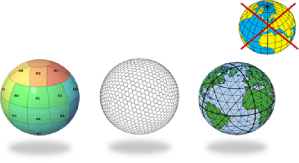
This is a compelling purpose; however, new knowledge is required before Digital Earth can be a reality. Peterson has concluded that Digital Earth cannot be built on conventional analog coordinate reference systems like latitude and longitude that represent the Earth as a continuous data structure. Instead, he has been investigating the use of a new digital earth reference standard that he helped create with members of the Open Geospatial Consortium called a Discrete Global Grid System (DGGS). Last month DGGS became a new ISO Abstract Specification.
“Digital Earth requires a “digital” earth reference system like the data structures that support other digital signal technologies: digital photography, audio, or video signals. We have had a sacred belief in traditional coordinate systems, but it is time to put away our vinyl records so to speak and enter a new era of digital Earth based applications. The best way to automate the geospatial communication model is to align data on a common digital discrete global grid structure, analogous to self-synchronizing messages in digital signal processing.”
The application and adoption of University of Calgary Digital Earth research will increase the opportunity for connecting everyone to places and promote better decisions over a broad range of complex issues from local to global importance, across multiple economic, social, and environmental activities.
